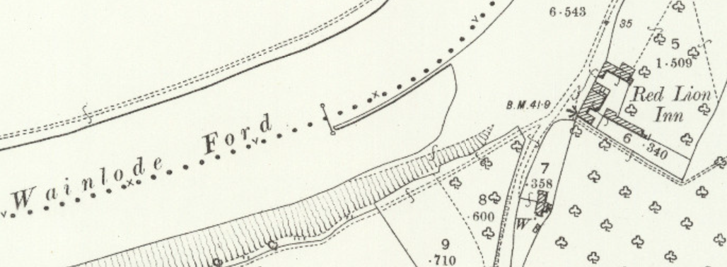
Wainlode
In an article entitled “In and around Gloucestershire with pen and camera” written by Gerald Clinch and published in the Gloucestershire Chronicle newspaper of 5th October 1912 it was Norton’s turn. Amongst other things he wrote “… the proximity of Wainlodes Hill – so called from the fact that in very ancient times the ‘wains’ of corn were brought down here and ‘loded’ on to the boats and taken thence to Gloucester”. I prefer the suggestion that ‘wain’ was a wagon and that ‘lode’ a river crossing point. An article that appeared in the Bushley Almanack for 1908 puts forward this same proposition. It does not give the authors name but he appears to write from personal knowledge. He says that Wainlodes means literally ‘a wagon road - a shallow ford in the river by which a wagon could be led across' on foot. In 1858, locks and weirs were built at Tewkesbury and Gloucester which had the effect of raising the level of the river between those two places by six feet. So then, before that date the river at the Red Lion was much shallower. The writer was in fact present at the opening of the locks at Tewkesbury. He also says that there were old people he knew who could remember when boys could cross the river on foot at The Mythe. He further says that until 1828 there was no bridge across the Severn between Gloucester and Upton -on-Severn.
In earlier pre-history it is said that the Ancient Britons had an encampment on top of Wainlode Hill and that the line of the road from the village to the river was part of the Ancient British Western Trackway. In later times, the Romans took the trouble to build a road down to the river at Wainlode and evidence of this has been found at Norton Green and along Wainlode Lane from Cold Elm; also a name with Roman derivation. The thought that earlier ‘residents’ of Norton built roads to the river here would also support the possibility that the river could be forded here all those years ago.
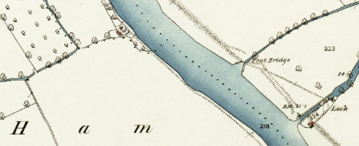
1844-1888 OS 25inch 1st Edition
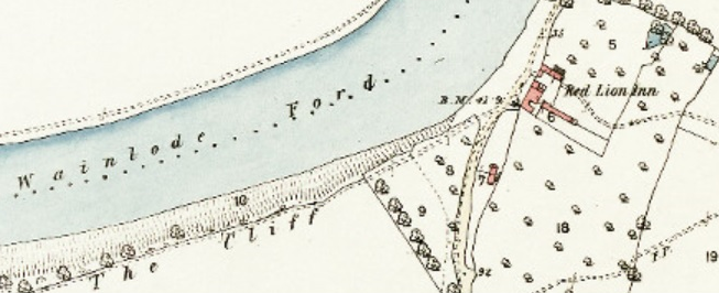
The above map extract actually names this stretch of the river as ‘Wainlode Ford’ and this naming continues in later revisions of the OS maps.
At the General Sessions of the Peace for the City of Gloucester, at Michaelmas 1647, the inhabitants of Norton were ordered to repair Wainlode Bridge before the end of November, or £5 to be forfeit in default. At the General Sessions of the Peace for the City of Gloucester, at Easter 1653, the bridge is mentioned again when John Butt made a plea of denial for the inhabitants of Norton for not repairing a bank near Wainlodes Bridge and they were found ‘not guilty’. Although not guilty of the charge, evidence was given that the inhabitants of Bishop’s Norton should repair the bank from the foot of Wainlodes hill to the withy tree and the inhabitants of Priors Norton should repair it from the withy tree to the bridge and it was ordered that the repairs be done accordingly. At the same Sessions, it was ordered that the inhabitants of Norton contribute to the money John Butt had laid out for prosecuting the case with the parish churchwardens making a rate for this. It was also ordered that they may sell the goods of any person refusing to pay. These are the only references I have seen to a bridge at Wainlode. Perhaps this wasn’t a structure that we might identify as a bridge today but may have been simply a causeway that allowed the river to be forded here.
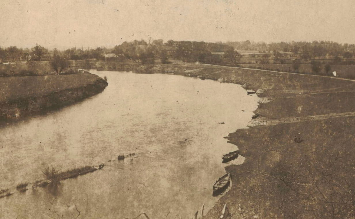
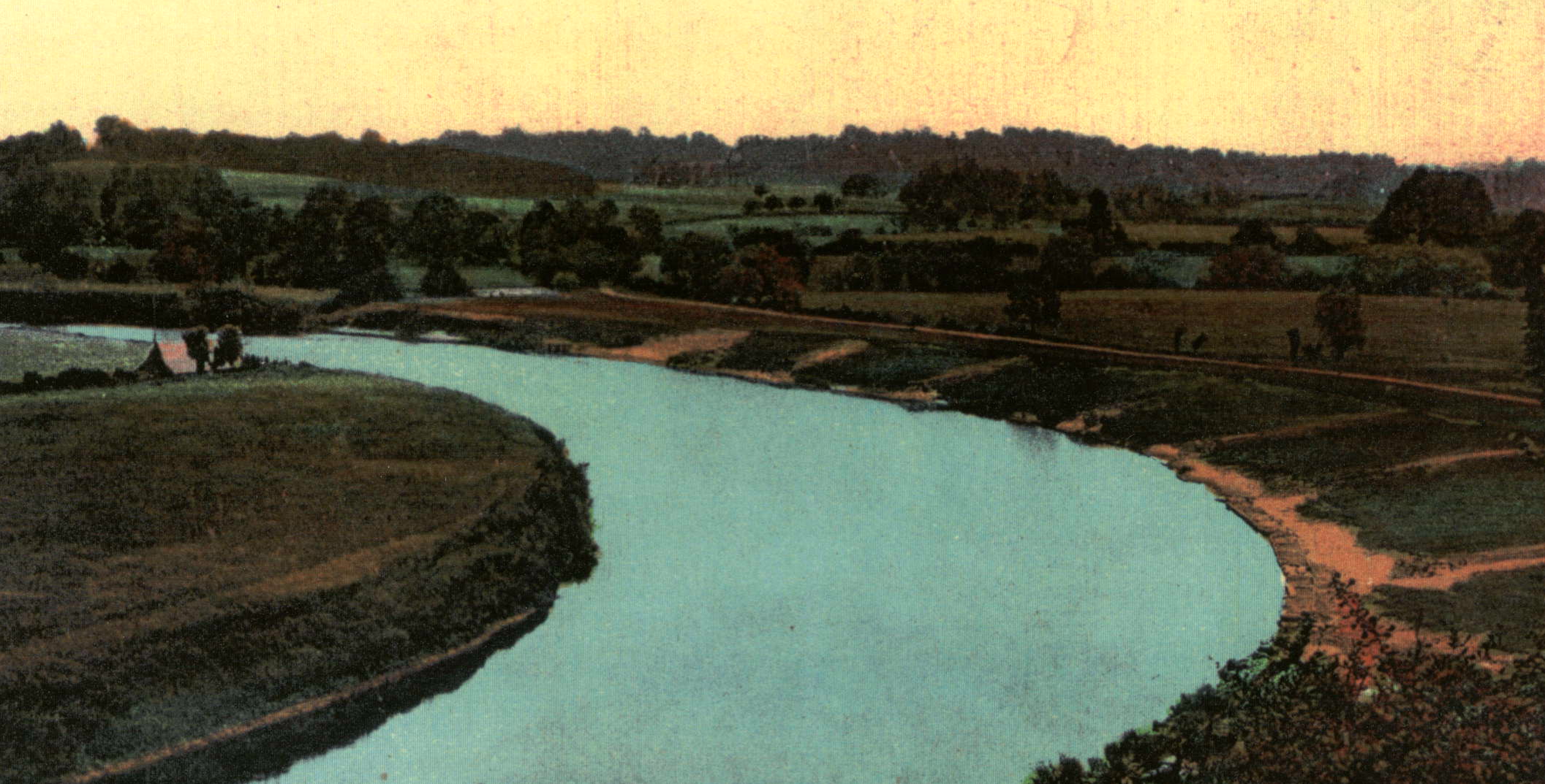
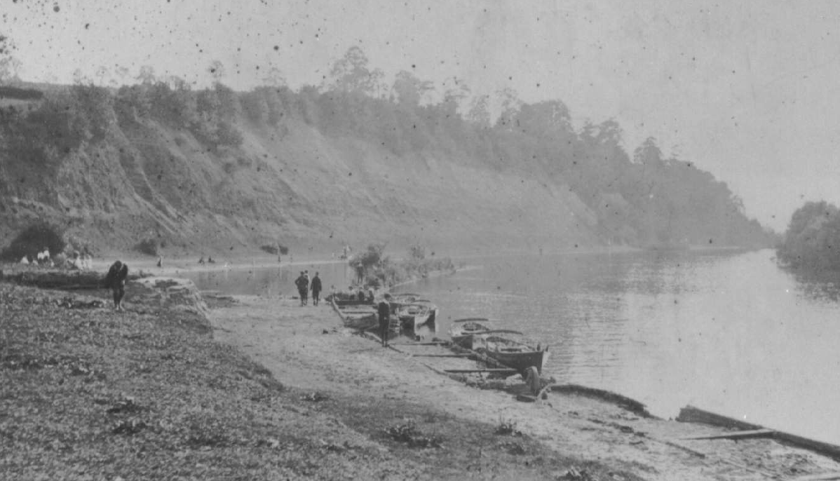
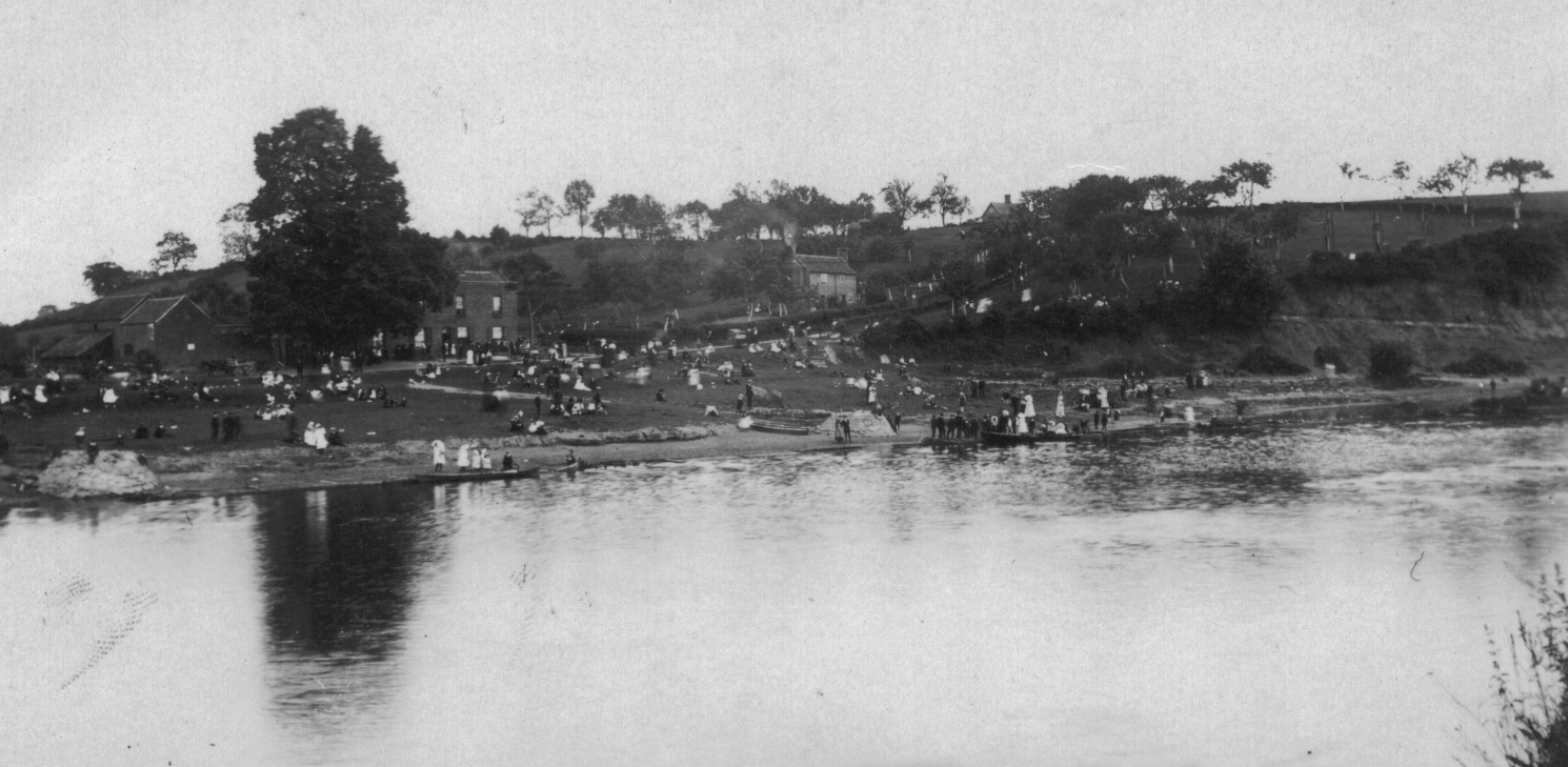
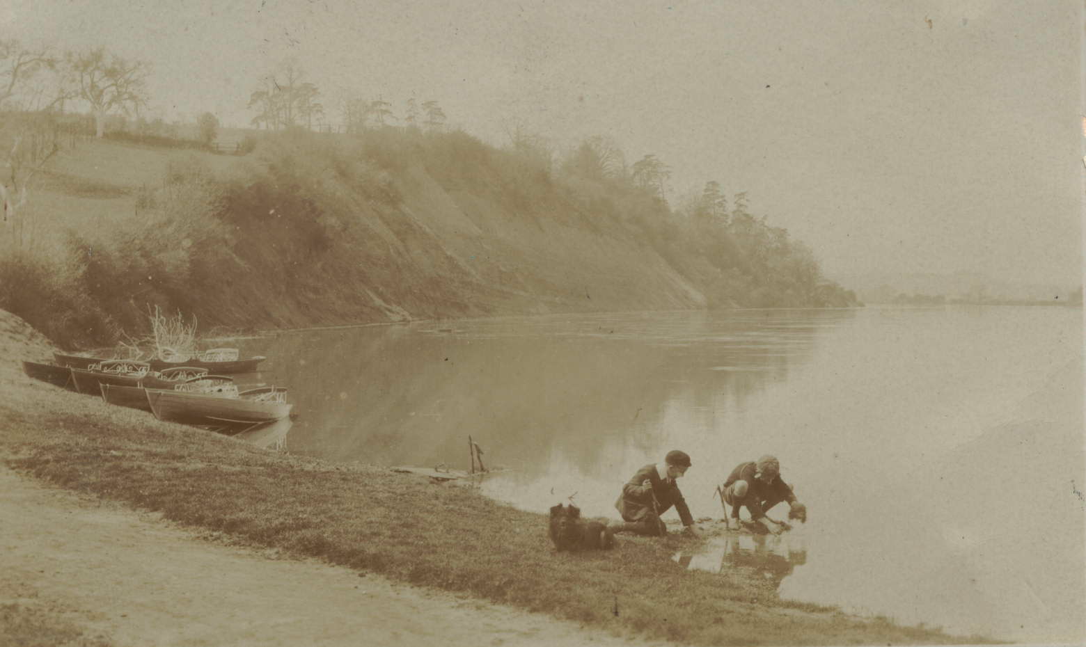
In 2019 Michael Phelps recalls; “The ancient crossing at Wainlodes mystifies me as today the banks are so steep as to make it impossible for a wheeled vehicle or cart to negotiate. Perhaps someone has an idea”. The following photo, although now poor in quality, suggests that there didn’t use to be any banks as such at Wainlode and it would have been no problem for a wagon to have entered the river here.
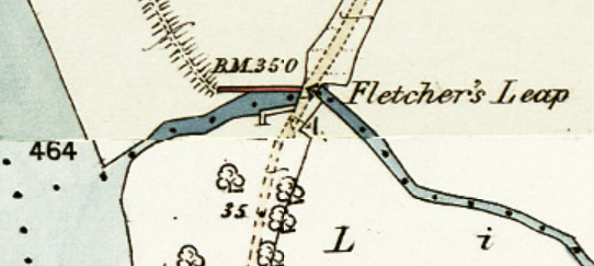
Whilst discussing name derivation, what of Fletcher’s Leap ? The short stretch of the River Chelt that runs between the River Severn and the bridge over Wainlode Lane is known as ‘Fletchers Leap’. The story has it that a highwayman was escaping from the scene of his crime along the plocks at Wainlode and encountered a gentleman returning from a shooting trip with a gun over his shoulder. He decided that his only course of escape was to leap over the narrow river next to the bridge. Presumably his name was Fletcher and he has been immortalized in this act.
It has always been suggested that it was the highwayman who was named Fletcher but perhaps it was the gentleman. Between 1705 and 1731 on Bishop’s Norton manor there were generally nine tenants, of whom three or four were freeholders paying a small chief rent. One of the freeholds was Fletcher’s, 39 acres of arable farmland, which was sold c1750. Fletcher’s freehold had enclosed pastures, strips of meadowland, and stints in the common pastures for cattle and horses. Additionally Fletcher’s had a homestead and orchards totaling 12 acres. When the hearth tax was assessed in 1673, of 47 Norton families, it was the Fletchers, along with the Browne family, that had the most hearths.
On 11 August 1681, a Thomas Fletcher of Norton, was buried in Gloucester Cathedral where he now has a memorial with Latin inscription. Could this be the family that gave their name to ‘Fletcher’s Leap’ and not a highwayman ?
In the 32nd year of King George III reign (1792) an Act was passed “for making and maintaining a navigable canal from the foot of Coombe Hill in the parish of Leigh … to join the River Severn at or near a place called Fishers otherwise Fletcher’s Leap”. This is the only reference I have come across to the name 'Fishers'.
Of course all of this is a romanticised story but no doubt there is some element of fact in there somewhere, there usually is in such cases. Anyway, Fletcher’s Leap is still how this point is known and has even made its way onto the Ordnance Survey maps and into poetry.
1844-1888 OS 25inch 1st Edition
In 1926 W D Vizard published a book of his own poems entitled “In The Valley of the Gods”, written about places all around this area. He included a poem entitled ‘Round About Wainlodes’ from which the following extract sub-titled ‘Fletchers Leap I’ is taken.
“Full often at yon streamside there, And sometimes, too, (as he hath said)
By Fletcher’s Leap I’ve stood, My grandsire here appear’d;
Where winding Chelt comes brawling down And there, beneath the willow boughs,
To Severn’s lordly flood; A salmon once he spear’d;
There often, too, while yet a lad, ‘ Twas there, where, from the treach’rous depths,
I’ve watched the hours away, The lofty banks ascend,
Watching old Dunn toil at his nets, Just where the laden barges sweep
And bring the fish to bay: Around the Horseshoe Bend.
See, there the fisher’s cot and hut Alas ! his witching tales and he
Are standing to this day. Have long since come to end.”
According to the poem the “fishers cot and hut” was still standing in the 1920s. The following photograph looking over the river from Wainlode Hill taken at about the turn of the twentieth century does show a building here but nothing more is known about it.

I have checked the Ordnance Survey maps for 1903 but they do not indicate a building here only the lock cottage where the Coombe Hill Canal meets the Severn slightly further up river and that can also be seen on the above photograph. I have recently walked the laneside around Fletchers Leap and there are traces of what may have been stone foundations and red brick walls still to be found here; could this be the last remains of Old Dunn’s cot ?
Tony Bradshaw, who grew up at Dunsworth Cottage, Norton, in the 1930s added the following information about these cottages when talking to me in about the year 2000. Tony told me of a cottage by the riverside in this area, maybe the one pictured, that in the late 1930s was occupied by a family named Townsend. His sister Joan recalls that the occupants prior to this time were a family by the name of Gardner. Tony was at school in Norton with the son of this family, Timothy, who would be absent from class for weeks on end when the river flooded leaving the family stranded from the ‘mainland’. Tony does not know when this house was demolished but suspects that it was after the severe floods of 1947.
Neither Tony nor his elder sister Joan can remember any buildings by Fletchers Leap, nor indeed can anyone else I have spoken to about this.
In 2019 Michael Phelps recalls; “Lock cottage at the canal entrance had a family living there until after the war”. Michael added; “Across on the Haresfield side was another ruined house that had been abandoned many years before. These people had to be really tough to live in such a place with the certainty of a flood each winter. Further down opposite the cliff was an enclosure where hay from off the Ham was stacked before being trussed up and loaded onto boats and taken up to the Black Country to feed the pit ponies. Coal was brought back on the return trip”.
The only house I can find on old maps was further north than the outflow from the Coombe Hill Canal – shown on the 1844-1888 OS 25inch 1st Edition map, above.
This undated photo does show a building almost opposite Fletcher’s Leap that doesn’t seem to appear on any maps.
There is evidence of work at Wainlode going back to the early 19th century and in turn to people being here at a much earlier date. The Gloucester Journal newspaper of 8 July 1811 reported; “A few days since, as some workmen were digging gravel at Wainload’s Hill, on the estate belonging to Colonel Webb, in the parish of Norton, near this city, about three feet from the service they discovered four human skeletons; but when or by what means they were deposited there, remains for the antiquarian to investigate. Alongside the bones was found some sort of metal, probably something they wore about their persons, but so cankered by time as to be hardly discernible of what kind, though it is supposed to have been brass”. Unfortunately I have not been able to find any follow up to this story anywhere.
More evidence of their being a ford at Wainlode ‘from time immemorial‘ comes when the Gloucestershire Chronicle newspaper of 5 November 1892 reported the following under the heading ‘Improvement of the Severn, Novel Dredging at Wainlode’; “At the meeting of the Severn Commissioners on Saturday, Mr H J Marten, CE, the engineer, reported that dredging at Wainlode Hill, Rock Ford, about six miles above Gloucester, had been carried out to the minimum depth of ten feet, pursuant to the Severn Navigation Act 1890. This ford, which from time immemorial, has been one of the great obstructions to the navigation of the Severn, consisted of an outcrop of hard marl rock, extending along the bed of the river for a distance of about half a mile. Attempts were made about forty years ago to remove this rock outcrop by means of blasting with gunpowder, but, prior to the recent operations of the Commissioners, a channel of about 20ft in width only, and having a navigable depth of about 6ft, had been cut through it, and this depth was sometimes lessened by accumulations of sand and other debris. The channel now cut through it has a bottom width of between 40ft and 50ft, with a navigable depth of 10ft at the ordinary low summer level of the river. This channel has been cut through the rock, not by the old method of blasting, but by means of strong steel claws attached to the bucket chain of the dredger; one pair of these claws being placed between each pair of buckets. These steel claws are somewhat in the shape of elephants tusks and they have effectually ploughed into the face of the rocks and broken it up into pieces of convenient size to be scooped up by the dredger buckets. Occasionally the dredging machinery and tackle were subject to great strain, especially when the steel claws grabbed hold of a more than usually tough piece of rock; but this difficulty was overcome, and the work has been carried out steadily and satisfactorily. The work has been done by the Severn Commissioners own staff, without the intervention of a contractor, and great praise is due to the workmen and others engaged in the work for the persevering way in which they have stuck to it from beginning to end”.
The need to dredge would have been to facilitate river traffic that no doubt was growing during the nineteenth century with trade from the Midlands making its way south through Gloucester to pick up the Severn once it became navigable to larger transports at Sharpness.
In his book Severn Traders: The West Country trows and trowmen (Pub. Lydney, 1999), Colin Green put forward the following; “Wainlodes was originally a wharf, the inn having been built to serve the boatmen. Coal was delivered here, in barges and trows, and the remains of small stone wharves to which they tied up are visible. The coal was carted to Cheltenham from here until the opening of the Coombe Hill Canal”. We know from other sources that the Red Lion Inn was several houses before being converted to an inn but the purpose of the inn opening may indeed have been to serve the river traffic. Just along the river at Apperley is a much more obviously named inn for this purpose; the Coal House.
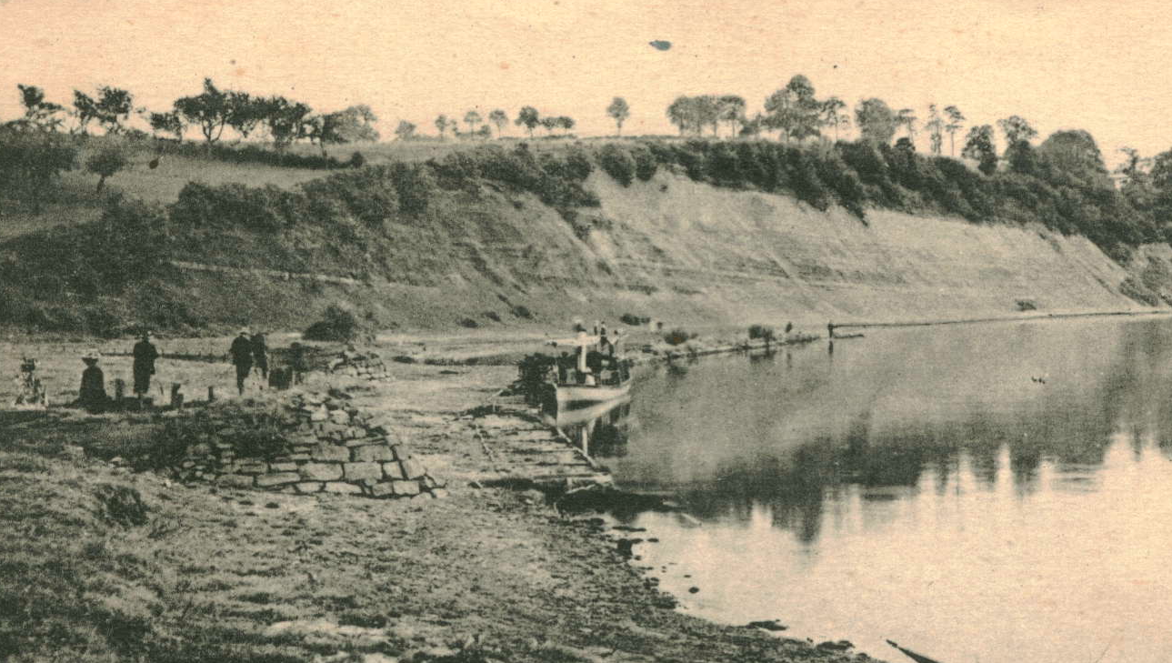
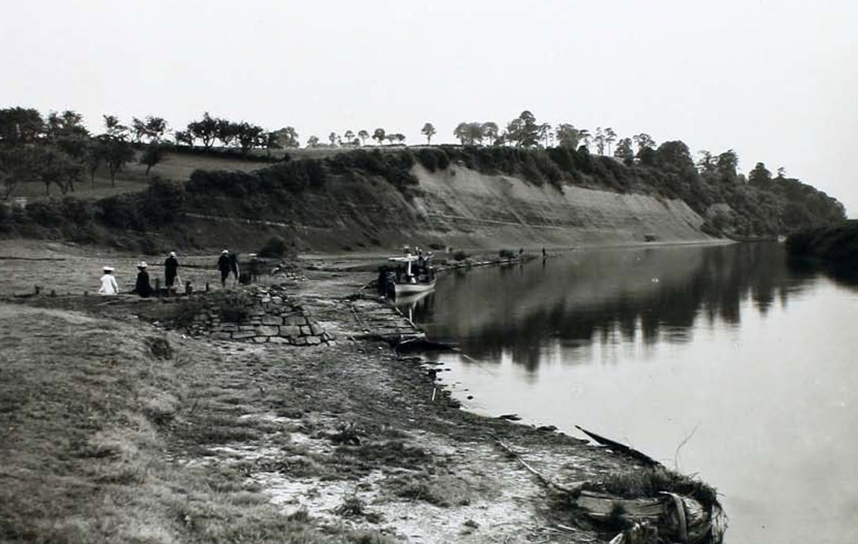
Something similar to the ‘small stone wharves’ to which Colin Green refers are certainly evident in the following, undated, photo.
The increase in river transport also brought people to the district and some were not to leave. The Parish Burial Register for 3rd February 1839 records; “By Coroners Order. A man unknown, after the inquest was recognised to be Thomas Bachford of Stourport, Captain of a coal boat on the Severn near Gloucester. Found dying in Norton about 7 o’clock in the morning and died about 11 o’clock noon of the same day – January 25th – in this parish”.
Access to the river at Wainlode was valuable not just to Norton but to neighbouring parishes as well. In 1897 it was actually proposed to cut the top off Wainlode Hill to lessen the steepness of the road incline. “At a meeting of the Gloucester Highway Board in January 1897 it was reported that Mr Norton Walker had written to the Board asking for their co-operation in addressing the steepness of the gradient in the road leading from the Red Lion Inn back towards Norton. It was suggested that the crown of the road could be excavated reducing the steepness and as a by-product giving the Board a quantity of good stone to be used in other projects. Mr Walker, Mr Strickland [Apperley] and one or two others were prepared to contribute towards the cost. Mr Jones, of the Board, mentioned that this was a valuable approach to the river and to Apperley and there were currently plans in contemplation to build a rough wharf at Wainlode for the unloading of stone and coal. [This might explain what the constructions were on the earlier photo and give us a rough date as to when they may have appeared]. Mr Jones thought that an alternative plan to slightly divert the road through the adjoining orchard would be the better and cheaper option”. The matter of the road over the hill came up for discussion again at a meeting of the Gloucester Highway Board in July 1897. Mr Cullis, who was attending the meeting to represent the views of Mr G N Walker, produced a section plan of the hill on the line of the existing road on which he had drawn three proposals for improving the gradient. He said that the road on the Norton side of the hill had a maximum gradient of 1:10 whilst on the river side of the hill it was as bad as 1:6 at its steepest point. The Board had proposed reducing the gradient to 1:12 which was proving troublesome. Mr Cullis proposed a rerouting of the road so that it passed through the orchard on the corner, thus by elongating the road in a serpentine fashion the desired gradient could be achieved. This was a prosperous orchard belonging to Mr Walker but he would agree to the work being done as this seemed to be the easiest and best option. There was opposition to this proposal with the alternative being to take off the crown of the road and raise the road at its bottom. Mr Cullis thought that raising the height of the road at the foot of the hill would cause problems to the Red Lion Inn, which was also Mr Walker’s property. It was then suggested that the license of the inn was more important than the building itself and that they ought not to sacrifice a proposal for road improvement for the sake of the house. The meeting closed with an agreement for a committee, along with Mr Cullis, to go and visit the site once again for further discussion. It was pointed out to Mr Cullis to pass on to Mr Walker, however, that whatever proposal was finally adopted the Board would only be giving a little towards its cost.
I can find no further reference to this scheme so can’t provide an outcome. There is certainly little evidence that the road was excavated and it doesn’t appear to have been recut in a ‘serpentine fashion’ through the adjoining orchard, and the Red Lion Inn is still there, so perhaps it is safe to assume, unsurprisingly, that nothing materialized.
Due partly to the sharp bend in the river and the nature of the earth in the cliffs at Wainlode erosion has always been an issue here. Looking into the centre of the river now it is possible to see a row of barges largely submerged but with poles standing erect from them to alert river traffic to their presence. It is hard to believe now that these were once sunken into the riverbank here to help slow down the erosion process. It is unfortunate that we do not have a date for their installation but they do feature on a number of photos.
The map extract, above, is taken from the 1894-1903 OS 25inch 2nd Edition. Just to the right of ‘Wainlode Ford’ something can clearly be seen as a dark line along the river, surely this is the barges ?
This photo, yet again undated, would appear to have been taken not long after the barges were put in place. It can be seen that although the barges were sunk into the bank for a short distance they also continued into the river leaving a secluded pool near the cliffs.
The following report from the Gloucestershire Chronicle newspaper of 22 August 1891 may provide some insight as to when these barges first appeared; “Dredging at Wainlode’s Hill – The two powerful dredgers of the Severn Commission have been busily at work since Tuesday in last week removing rock, gravel, sand, and clay from the bed of the river Severn at Wainlode’s Hill. Several thousand tons have been dredged up and placed on faggots in the water against the bank on the Norton side of the river. By this means the channel will not only be deepened but narrowed at this point”.
This may have been an earlier attempt to prevent erosion or perhaps the faggotts were placed in the barges to hold the dredged sediments together. The description certainly fits with the position we find the barges in today.
In 2019 Michael Phelps recalls; “70 years ago the average summer river level was several inches lower than now. The sunken boats were always visible, even grass and small trees grew there. This was brought about by raising weirs at Maisemore and Llanthony to improve the navigation upstream. When this was done no warning markers were installed over the boats leaving a very dangerous situation with the boats just a few inches under the surface. A stranger to the area once had the bottom of his boat ripped out. After that warning signs were installed”.
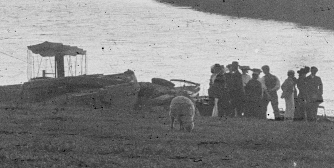
Undated photo of a group of people arriving or departing Wainlode by boat. Interesting to note that sheep appear to be grazing here at that time.
[1942]
Moving into the 20th Century and river traffic does not seem to have diminished. Bill Hannis, who grew up at No 3 Cold Elm Cottages in the 1930s, shared his memories with me in the late 1990s; “Swimming in the Severn was very dangerous in those days with undercurrents, whirlpools and waves from passing river traffic. Big John Harker petrol tankers, tugs towing up to 6 large barges down to the humble crumb and coal carriers. All long boats towing other long barges. You also had, on weekends, passenger pleasure cruises on the River King and River Queen making regular trips from Gloucester to Tewkesbury. Healings of Tewkesbury operated a fleet of grain barges. Boats were going up and down stream practically bow to stern. Upstream the boats were so heavily laden that the waves from downstream was washing the decks of boats travelling upstream. The waves also washed the banks on the Red Lion side and this was what caused erosion to occur even faster during wartime. All traffic kept to one side of the river, empty traffic one side and full the other where there was room to pass. I did not hear of any collisions. Large boat traffic was stopped going down river empty in times of flooding unless they were filled with ballast ie water”.
Over the years of researching our village I have heard a number of tales of local children being thrown chocolate from boats passing on the River Severn at Wainlode. I had never really given this much thought until walking along the towpath of the Gloucester & Sharpness Canal I noticed a stone in the long grass labelled “Cadbury Wharf Fretherne’ and this brought the old chocolate stories back to mind.
In January 2002, Hugh Conway Jones gave the Norton & The Leigh Historical Society a talk about the boatmen on the Severn and the Canal. He said that jobs from the Cadbury factory at Frampton-on-Severn were popular. Here they made raw chocolate which was placed in sacks to be taken to Bourneville. He suggested that these sacks were likely to rip a little and the chocolate crumb got passed around. Several of those present at the meeting that night could actually remember this crumb being passed out to children along the riverbanks. I have recently found a number of stories about this on the internet and apparently it was quite common for ‘boat chocolate’ to be handed out or to ‘go missing’ from barges.
Bill Hannis’ memories earlier in this article also refer to the fact that after the First World War Wainlode became a popular ‘beauty spot’ visited in great numbers by people from Gloucester and further afield. ‘Fun and games’ at Wainlode had started much earlier, however, although the following events from August 1905 would appear to have been for the benefit of villagers. The reason for the entertainment is not made clear but the occasion was sufficient for The Citizen newspaper to report; “A fairly numerous company of the parishioners of Norton sat down to a salmon tea at the Red Lion Inn, Wainloads, on Thursday evening. Mr Ralph James, of Tewkesbury, occupying the chair. Tea was followed by an interesting programme of sports. An exciting boat race resulted in Church beating his opponent by half a length. The ladies’ walking and running race was won by Mrs Barnes. Considerable amusement and interest was invoked in the cutting of a piece of string for a leg of mutton, each competitor having to walk 20 yards blindfolded and cut a string attached to a pole. G Stephens was the winner. A tug of war (married v single) ended in a win for the Benedicts. There were also other interesting competitions. Mr J Smith, Gloucester, acted as handicapper and starter, and at the close Mr William James returned thanks to the donors of prizes and expressed the hope that the amusements would be repeated next summer”.
I have heard Wainlode referred to as Gloucester’s seaside and whilst this is obviously an exaggeration it does seem to have become a very popular spot for the weekends and holidays.
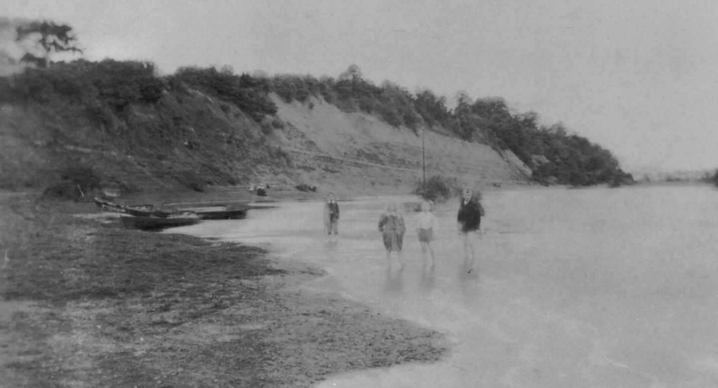
In the late 1990s, Dennis Williams of School House shared his memories of Wainlode in the 1930s; "As a family we would often visit Wainlode, on foot we would follow the river bank from Westgate Bridge, or occasionally go by bus to Norton Green and walk down the narrow lane to the river. The grass bank to the front of The Red Lion was much wider than now, it was always crowded, particularly at weekends and Bank Holidays. A string of sunken barges had been positioned to save erosion of the river bank; these were used as diving platforms, swimming being very popular. Wainlode was known as the ‘Gloucesters Seaside’. It was a crowded, happy, atmosphere, lots of bicycles, motor cycles and a few cars. After a long walk there father would go to the Wall’s Ice-cream tricycle (‘stop me and buy one’) and for a penny would buy a snow fruit; a triangular frozen lolly in a black and white card wrapper. This would be cut into three and we children would each receive a piece. This was in the thirties and money was short but we had our freedom and were able to roam anywhere without fear. On one visit I was paddling in the barges and foolishly stepped over the side, down I went into the depths of the river. Fortunately a young man seeing me disappear dived in and rescued me, more dead than alive he brought me to the shore. On my return to this world I knew I had been baptised in the River Severn, I had certainly drank my fill of it !".
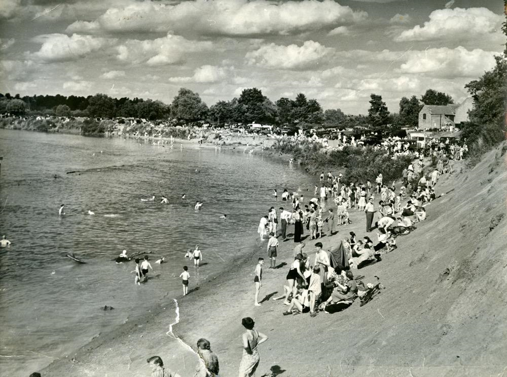
No matter how dangerous, swimming, or at least paddling, seems to have been popular.
The Citizen newspaper of 12 May 1934 reported on behalf of The Bristol Tramways and Carriage Co and their ‘Bristol’ Coach Tours; “Starting from Travel Bureau, Westgate St. Sunday, May 13th, Wainlode Hill (Norton Green). A Frequent Service will leave Worcester St, Commencing 2.30 pm”. The Citizen newspaper of 6 July 1934 tells us that this was a regular weekly service; “Every Sunday, Wainlode Hill (Norton Green) (Popular Riverside Beauty Spot”.
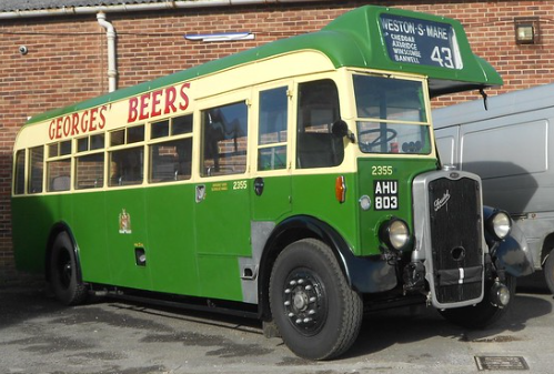
I believe that this is a 1934 Bristol Tramways Bristol J/Bristol Body
If you didn’t fancy going by road Bathursts Ltd were advertising ‘River Steamer Trips’ in the same newspaper; “The Steamer ‘King’ will run from Gloucester (Quay) to Wainlode, Lower Lode, and Tewkesbury on Sunday Next, July 8th, leaving Gloucester at 2.30pm, returning from Tewkesbury at 6.30pm. Return Fares: Wainlode 1/6, Lower Lode 2/-, Tewkesbury 2/6”. There is a small proviso included; “(Circumstances Permitting)”.
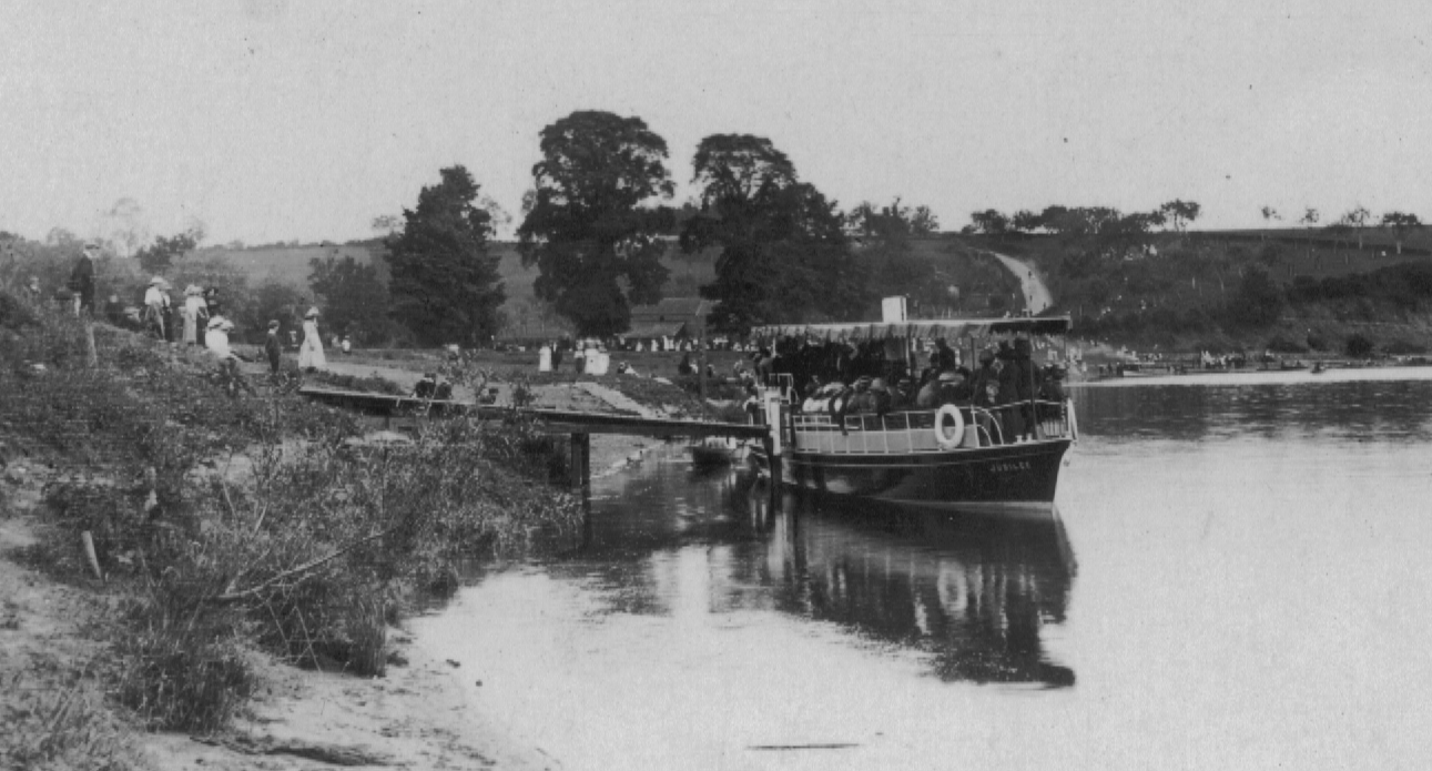
Photo showing the SS King, or similar unloading passengers at Wainlode.
The SS King, the largest of four passenger steamers owned by Charles Bathurst, was 71ft 6ins in length, was built of teak, with an 80hp engine by T A Savery & Son and was licensed to carry 192 passengers. It is believed that the SS King later became converted to a houseboat, was found in poor condition at Bristol in 1995, still survives today and last I heard was undergoing a full restoration. Bathurst ran services up and down the Severn for years but I was still a little surprised by the following notice for a passage during the Second World War and reported in The Citizen newspaper of 19 June 1943; “Steamer trips will be run from King John’s Bridge, Tewkesbury to Wainlode Hill on Sunday, June 20th, at 3pm and 6pm. Fare 2/6 per person, children half price”.
My mother, Sheila Maidment (nee Mullens), who grew up at Yew Tree Cottage, told me of her childhood memories of Wainlode from the 1920/30s; “… we were always outdoor children and spent lots of time in the fields, on the hill and down at the river at Wainlode. We would go swimming before and after school until we heard that a dismembered body had been pulled out of the water further up the river at Haw Bridge. The head was missing and we were all afraid it would come down river and we might stand on it; later we heard it was found many miles away so we resumed our swimming … From the top of the hill to ‘Devils Chimney’ – a steep path leading down to the river and a path under the cliffs to Wainlode. Sometimes we packed a picnic and the whole family walked this way to spend the day fishing …”
Jean Gray (nee Sparrow) grew up at Norton Court, where her father was chauffeur, in the 1920/30s. She remembers; “On summer afternoons we children would sit on the trees and watch the crowds trudging down to Wainlode, but we were waiting for the ‘Stop Me and Buy One’ man to cycle past”.
Bill Hannis had the following piece published in the Gloucester Citizen in late 2003. I have reproduced it here with the kind permission of Bill. “In the 1930s, I often went down to Wainlode Hill with my elder brothers and sisters and on Sundays in the summer my parents walked me down. I lived on the main road at Cold Elm, Norton. The green opposite the pub was about three times as large as today. There is a post, now in the middle of the river, showing river craft the deep water channel, this post was within six feet of the main bank. There was also a small strip of sand where you could paddle, one foot in water one out. My sister one day did this and she went in and she had gone down for the third time when she was pulled out by passers by. This was before I was born. She survived the ordeal. There was also steep cliffs we used to climb. On the green itself on summer Sundays they had a miniature steam railway track running the full length of the green, an engine pulling four open carriages, carrying about 20 people. There was also swinging boats, and other stalls, etc. Bristol Tramways operated a shuttle service of 20 seater buses from Gloucester to Wainlode on summer Sundays. At first they ran to the bottom of the hill but had difficulty getting back up again with a full load. The hill is very steep. Second World War put paid to all amusements”.
One local man who took advantage of all these visitors was Samuel ‘Ossie’ Hayward who lived in one of the cottages near the Red Lion (No 32 Wainlode) and who rented out rowing boats.
Could that be some of Ossie's boats in the background ?
In 1997 Tony Bradshaw who grew up in Dunsworth Cottage told me his memories of the American forces at Wainlode during the Second World War; "In 1943 they began to construct floating pontoon bridges over the river at Wainlode, near to the landing stage down towards the river Chelt. Later they built more sturdy Bailey bridges. The bridges would go up and down quite quickly as during their construction all river transport was temporarily halted. Later again they would concentrate on building smaller bridges over the River Chelt at Fletchers Leap to prepare themselves for all of the small rivers they would need to cross in France. There was little bridging machinery present and most of the work was constructed by man-handling the pieces into place. At one time they had a ‘Weasel’ at Wainlode. After they left the War Agricultural Committee was supposed to make good the damage done by their work but much erosion had taken place and this was not entirely possible".
Erosion continues to be an issue at Wainlode. Even during my lifetime the erosion of the banks of the Severn at Wainlode is most evident. Old photographs from the early 1900s show a much wider stretch of grass between the lane and the river than is there today. The erosion has been an ongoing issue for many years perhaps being recognised first with the sinking of the barges to brace the bank. These barges are now to be found almost mid-river indicating the amount that the banks have eroded. In 1947 Norton Parish Council wrote to the Gloucestershire County Council about this very issue and received the following reply dated 16th May 1947 :-
“In reply to your letter of the 4th April, I am to state that the representations of the Norton Parish Council in this matter [Severn erosion] have been considered by the Land Drainage Sub-Committee of the County Council. So far as concerns the suggestion that the Catchment Board have obligations in this matter by virtue of Section 9 of the Land Drainage Act 1930, the County Council are advised that the provisions of that section only apply where some person is already under a legal obligation by virtue of prescription, tenure, or otherwise, to repair the banks and have no application to flood banks which private owners may have erected in the past for their own protection but which they are under no legal duty to maintain. The powers of the Catchment Board in this matter appear therefore to be of a permissive, rather than an obligatory, nature. In fact, however, the Council understand that the Catchment Board desire to take remedial measures but are unable to proceed with any plans directed to that end until the tentative scheme for the improvement of the navigation of the Severn has been settled, a scheme which it is understood is held up pending a decision by the Minister of Transport upon a question of policy. I am therefore to inform you that on the instructions of the Committee I have addressed letters to the Severn Commissioners and to the Minister of Transport urging that all possible steps should be taken to expedite a decision upon the proposed navigation scheme so that the Catchment Board may be placed in a position to proceed with the carrying out of measures to deal with the erosion problem”.
The issue raised its head again in 1956 when Norton Parish Council received a letter from Maisemore Parish Council asking for co-operation in an effort to bring the County Council’s attention to erosion and copying a letter that they had themselves sent to the County Council, dated 25th January 1956, and reading as follows; “Great anxiety has been felt for some years at the increasing rate at which erosion to the banks of the Severn, above Gloucester, is taking place – with consequent serious loss to property. The chief cause of this erosion is undoubtedly the power driven barge. British Waterways have now declared their intention to increase this traffic on the Severn by at least 50%. We ask the Glos County Council to take all the means they can to ensure strict control of the operation of this traffic, so as to minimise as far as possible the damage done to the river banks”.
With Norton being a riverside parish it is likely that fishing has always been prevalent at Wainlode. From the Parish Burial Register for 2nd February 1809, provides evidence of a boating accident, most likely on the river at Wainlode; “John Baylis, John Holder, Richard Lea, John Bridgeman and William Barnard, were buried. The above five last named men were unfortunately drowned”. The Gloucester Journal newspaper of 6 February 1809 tells the tale; “Yesterday, sennight, during the height of the flood, as five men (Rich Lea, John Holder, John Bridgman, Wm Barnard and John Baylis) were returning from Norton in this County to Wainlode Hill, in a boat they had borrowed at the latter place, they were overset by the violence of the wind and the waves, and all unfortunately drowned ! Two little boys were the only spectators of the accident. On Tuesday the bodies were found, and, on Wednesday, inquests were taken before Dr Willey, Esq, coroner, when the verdict, in each case, was accidental death. Bridgman has left a wife and six children”.
Whilst there must always have been fishing at Wainlode, The Citizen newspaper of 11 September 1933 reported on the earliest competition I can find taking place there; “The annual Bourchier Cup fishing competition took place on Sunday on Wainlode Hill, under the auspices of the Gloucester United Anglers Association. In the unavoidable absence of the Mayor and Mrs W L Edwards, Mr Walsh, the manager of Messrs Blinkhorn’s, fired the gun to start the contest at 1.15pm. The competitors fished for three hours. There were about 264 competitors, Mr Jack arsons, the secretary of the club, told a ‘Citizen’ reporter. ‘The fishing conditions were very choppy’, Mr Parsons said. ‘The wind was in the wrong direction, and the water low and muddy. In spite of this, however, every competitor took fish, and many good bags were set on the scales’. The winner of the Bourchier Cup was Mr C Green, of the White Lion Club, whose total catch weighed 2lbs ¾oz 1 dram. Mr F Hackers, of the Sharpness Club, took the Alcock Bowl and Medal, with a catch of 1lb 13½oz, 1½ drams. Next came Mr F Cresswell, of the St Catherines Club, with 1lb 12¼oz 2 drams, and Mr T Vickery of the Crown and Thistle Club took fourth place with 1lb 10½ oz 1½ drams. Mr Walsh presented the prizes”.
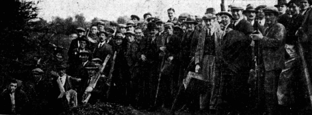
Gloucester United Angling Association Competition, Wainlode, 1934
When I first read the above article I was surprised by the number of anglers who were taking part in the competition … until I read another article from just the following year. The Citizen newspaper of 8 October 1934 reported; “The 43rd annual contest of the Birmingham Anglers Association, in the waters between Worcester and Wainlode Hill, Gloucester, was, considering the weather conditions, in every way a success. The 4300 competitors reflected the growing interest in the sport, the entries showing an increase of more than four hundred compared with the previous year. One of the interesting features of the day was the increased number of women competitors, who showed they possessed both skill and patience and an appreciation of skilful fishing. The transport of all these anglers from Birmingham to the lower Severn was a gigantic task. It involved the chartering of special trains to Tewksbury and of steamboats to carry competitors thence near to the places allotted them by the luck of the draw – up to within a few miles of Worcester and down to within sight of Gloucester. In all the chain of anglers was close on 50 miles”.
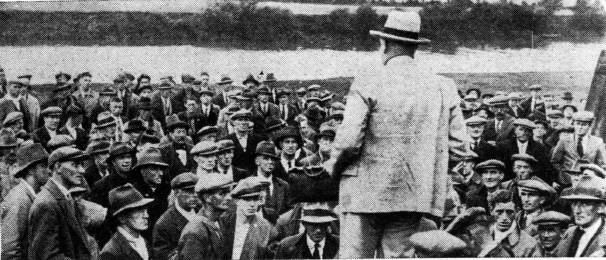
Gloucester United Angling Association Competition, Wainlode, 1934
Gloucester United Angling Association again held their annual competition at Wainlode in 1936. 266 anglers took part but with a fair amount of discoloured fresh water in a river that was running high the catch was below the average that had been caught for many years.
As well as ending the annual amusements that used to feature at Wainlode, the Second World War also brought new stories and memories of the are; Tony Bradshaw, whose memories I have recorded earlier in this article, also remembers the Americans in the village during the War; “They camped at Spring Orchard and in 1943 began to construct floating pontoon bridges over the river at Wainlode, near to the landing stage down towards the river Chelt. Later they built more sturdy Bailey bridges. Bridges would go up and down quite quickly as during their construction all river transport was temporarily halted. Later they would concentrate on building smaller bridges over the River Chelt at Fletchers Leap to prepare themselves for all of the small rivers they would need to cross in France etc. There was little bridging machinery present and most of the work was constructed by man-handling the pieces into place and at one time they had a ‘Weasel’ at Wainlode”.
After the Second World War things returned to a degree of normality and Wainlode once again became a place for day trips. In about 2000, Brian Welch, late of Court Hay Farm, shared the following memories of a river trip from Gloucester to Wainlode aboard SS King in 1946; "It was at the end of the second world war, probably in the summer of 1946, that myself, together with my mother and sisters, three aunts and one or two cousins, embarked on the River Steamer King, at The Quay, Gloucester, outward bound for Wainlode. It was for us children an exciting event for which we had been looking forward for days. Holidays and days out had been nonexistent through the war years and a steamer trip out to the real countryside at Wainlode was a welcome change to Gloucester and Longlevens. The Quay in the mid nineteen forties was far different from today. The Severn was an important and busy highway and every evening the quay was crowded with tugs and barges moored overnight. There was no fence to keep you back from the quay wall as there is today. From a point opposite the Old Customs House and upstream towards The West Midland Farmers mill, (now Country-Wide Farmers), were several small coal yards each backing right on to the quay wall. Amongst these was J. Major & Co Ltd where my father spent most of the early-middle years of his working life. Tied up to the quay, immediately opposite the Ship Inn, was a traditional flat-bottomed Severn punt and either in it , or on top of the wall could usually be seen a set of eel putcheons belonging to the landlord’s son. These traps were set in the river each night and must have provided an additional income from the harvest of eels. This sadly came to an end when the fisherman fell into the river one night and was drowned. The Ship Inn is still there but is no longer licensed. [Its now been demolished]. The first structure we came to on our trip upstream was Westgate Bridge. This was a prefabricated bridge, built as a temporary measure to carry the extra traffic and weight created by the war and it was replaced by a permanent structure shortly after. Immediately above the bridge, moored to the Gloucester bank, was a pontoon and at this point you could hire a rowing boat on the river. It does seem strange that in those days, when the Severn was busy and dangerous to small craft, that you could row on the river and nowadays, with the river quiet and hardly a commercial vessel to be seen, you cannot. The field here on the west bank is St Catherine’s Meadow. In those days there was nothing in it except sheep. Today there are one or two buildings there and part of it is used as the King’s School playing field and also for county cricket. Just a short distance further on we passed under the Black Bridge, a steel bridge that carries the South Wales railway line over the river. I always knew it as the Black Bridge but it was also known as the Pumphouse Bridge. The bridge then had a central pier in the middle of the river but as this caused a problem to large tankers trying to negotiate the bend in the river it was rebuilt in 1957. Right alongside the railway embankment, and only a few yards from the river was the Black Bridge pumping station. Before the war, when I lived in Gloucester and was five years old, my grandfather, who was a G,W.R. railway fitter, took me into this station to show me the machinery. Inside was a steam locomotive, set up on blocks, steaming a way with its wheels turning and going nowhere. It was being used to drive water pumps. I have no idea from where the water was being pumped. The remains of the building can still be seen and I still recall the excitement of seeing that engine working away out of sight in that long brick building. There are some good views of the cathedral from the next stretch of the Severn. Some disused brick pits are on the Gloucester bank and a little further upstream is the Jolly Waterman. It was formerly a public house, no doubt serving the crews of the horse-drawn boats that plied the river in days gone by. It was never licensed in my memory but was, and still is, a private house. There was in those days an area of rough land, covered in brambles, stretching from this point almost back to Sandhurst lane. My aunt lived nearby and I often went with her in search of blackberries. I recall one day a man approaching us and introducing himself as a Dr Wilde from Gloucester City Museum. He showed great interest in the stick that my aunt had given me to pull the berries down with. It was simply cut from a branch of a tree and he was quite excited when she agreed with him that it was called a “pickthank”. I have never seen one used since nor have I ever heard that name. Further upstream the river bends almost through ninety degrees to the left and at this point flows within fifty yards or so from Sandhurst lane. Between the lane and river is the Globe Inn. It was a quiet country pub in those days, became a private house after the war and, after many years, was re-opened under the same name. I wonder what the name refers to ? Half a mile upstream we came to the Upper Parting marking the northernmost point of Alney Island. Here the Severn splits into two channels. The Eastern Channel or Gloucester water, along which we had steamed, rejoining the Western Channel or Maisemore water immediately below Gloucester. Right opposite the Upper Parting was the Tar works. I cannot recall any serious problems with the industry that was carried on there in those days, It was thirty odd years later when C.S.G. had taken over the site that unpleasant smells and health threatening pollution fears followed by an explosion, caused action in both Sandhurst and neighbouring parishes. The most unpleasant smell in those days came from the slaughterhouse that also operated in Sandhurst some distance upstream from the Tar works. After steaming the best part of a mile up Long Reach, a long sweeping bend took us to Ashleworth Quay. At the time of our cruise the ferry still operated here across the river. Sometimes my father would drive through Sandhurst to Brawn Farm and down the lane to park the old Morris 8 on the bank opposite the quay. A call would bring the ferryman across in his long black punt and he would take us across the river. We would then walk upstream for a field or two on the Ashleworth bank for our mornings fishing. Anglers of course are like an animal grazing in a field, the grass being always greener over the other side. It was at this point that the towpath changed from the east bank to the west and there was formerly a chain ferry large enough to transfer the horse to the opposite bank. This was necessary to avoid natural obstacles such as Wainlode Hill and the river Chelt further upstream. The use of horses to tow barges died out before the Great War in around 1912. From the next reach of the river we got a fine view of Sandhurst Hill, in effect the reverse side of our Norton Hill, and soon we were steaming alongside the cliff at Wainlode and keeping to the deep water channel to the left of the sunken barges. Much more of these barges was visible in those days than currently. I have been unable to find out when they were first positioned there but it must be the best part of a hundred years ago if not longer. Their purpose of course is to prevent the river from scouring away the bank in front of the Red Lion and at the base of the cliff. At the time of our cruise, and for very many years afterwards, the almost vertical face of the cliff was bare of vegetation and the different strata in the soil was a prominent feature. Over comparatively recent years the cliff face has become more or less covered in grass and shrubby growth and presents quite a different appearance. There was a lot of river traffic in those days. Two or three barges being pulled by a steam tug were commonplace together with oil tankers. The movement of these vessels with their propellers stirring up the sediment helped to keep the navigation open. Today river traffic is almost exclusively confined to the occasional private motor launch and the river has silted up considerably. Wainlode has changed little since the days of our cruise. The Red Lion looks very much as it always did and, apart from the recently erected fences, the Green is just the same. The wooden landing stage, to which the R S King tied up that long gone afternoon has disappeared years since. It was much closer to the outfall of the river Chelt than the Red Lion. The river Chelt itself was moved a few yards downstream just a few years ago when a new road bridge was built and a new channel was cut for its last fifty yards or so before it joins the Severn. I clearly remember going ashore that afternoon and walking along to the pub. We kids were famished and were looking forward to getting something to eat. Sadly it was closed and we went hungrily away. My strongest memory of the return trip downstream was of chewing on cousin Iris’ rusks, (she was probably eighteen months old), there being nothing else to eat until we arrived home".
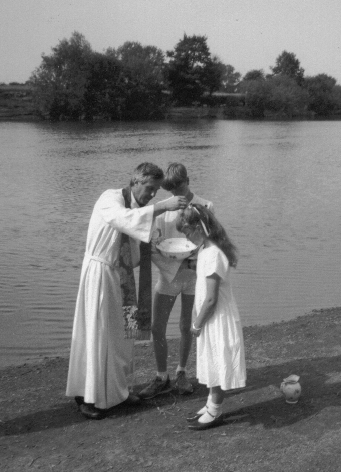
Since the war Wainlode has seen all sorts of activities including a baptism. The Gloucestershire Echo newspaper of 29 June 1986 carried the following article; “A double christening has been performed on the banks of the River Severn at Wainlode Hill, Norton. It is the first christening in living memory to be performed on the riverbank with Severn water. The vicar of Norton and Sandhurst, the Rev John O’Brien, performed the historic ceremony when he christened seven-month-old Victoria Hobbs of Oxstalls Lane, Gloucester, and Emma Truby, 11, from Bentham near Cheltenham. During the service, opposite the Red Lion Inn at Wainlode, the vicar blessed water from the Severn. He was assisted by Miss Julie Norton from the USA who is on a working holiday. Emma Truby’s grandmother Mrs Joan Mitchell has been the landlady of the Red Lion for many years. Emma’s mother Mrs Ann Truby said “I was born and raised at the Red Lion so we thought it would be nice to have the christening nearby”.
Whatever changes come with the passage of time it would seem that Wainlode being regularly flooded is never going to change.
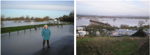
Photos from early 2007.
Wainlode continues to be a popular spot with the Red Lion Inn now being the focus of visitors attention be it for their food and drink or for the caravan and camping facilities in the fields to the rear.
